Uncategorized

Sensational! Tens of thousands of unknown geoglyphs have been found in the Sahara.


The Sahara Geoglyphs are a unique phenomenon and an archaeological sensation of today. This grand phenomenon has yet to be reconsidered and studied in detail. But even now we can speak with confidence about another riddle of the past, of a scale no less than the mystery of the Nazca Plateau geoglyphs and many other similar mysteries. It can be said that the Sahara geoglyphs are the African Nazca desert, but considerably larger.

There are no lines and drawings here, but there are tens of thousands of grand objects laid out of heavy boulders. They are located on a huge area and occupy almost the entire central part of the Sahara.

The work on the creation of geoglyphs is striking in its colossal scale and, most importantly, in the absence of an acceptable reason that prompted it to be done. Therefore, to explain the origin of this phenomenon in the academic version of history will be very difficult, but most likely – impossible.

At the moment, this is what can be said about the Sahara geoglyphs:

1. They are surely geoglyphs. I.e., they surely are artificially created objects on the surface of the Earth in the form of images of certain symbols, which can only be fully viewed from a height.

2. Their number is huge. To date, as part of the GeoLines.ru project, over 20,000 individual characters have been exactly located. And it looks like it is only the beginning.

3. Geoglyphs occupy a huge area, more than 2 million square kilometers. The distance between the individual elements is more than 2000 km in the latitudinal direction, and more than 1000 km in the meridional direction.

4. The sizes of geoglyphs range from a few meters to several hundred meters. The perimeter of some images is more than 1 km. But the bulk of geoglyphs has dimensions of about 30 to 60 meters.

5. In most cases, images of symbols on the surface of the desert are laid out with stones, most likely collected in the area. The exact origin of the material from which the geoglyphs are made can only be determined after studying it at the site.

6. All geoglyphs, with a very high probability, are an integral system, and are interrelated, both between themselves and with other objects of the System of Ancient Monumental Structures (SAMS).

7. In the arrangement of symbols relative to each other, the same principles are observed as in the arrangement of other objects of the SAMS. Due to this, the Sahara geoglyphs make it possible to determine very accurately cardinal directions and the direction to some of the key points of the System.

On the pages of our website you can get the most complete information about the geoglyphs of the Sahara, at the moment.

In the section “The Sahara geoglyphs” published the book of the same name, which provides General information about the geoglyphs. Describes the types, location, dimensions, construction methods, and relative position of some regularities linking the Nazca Sahara with the most mysterious buildings of antiquity. Feel free to click on the banner ads. This will support and accelerate the further development of our project.

The electronic version of the book can be purchased on the page of the publishing house “Ridero” or in other online bookstores.

In the “Photos” section you can see real photos of the Sahara geoglyphs on the ground. Here are selected more than 2000 images of the most interesting geoglyphs, which are structured by type.

In the “Files” section you can download the file for the program “Google Earth” in kmz format., which contains the exact location of the Sahara geoglyphs. All geoglyphs in the file are numbered from 1 to 20***. The only difference is the abbreviation before the number, which indicates the type of geoglyph.

At the moment the file contains about 5000 objects. But, as ready, it will be constantly updated and supplemented with new objects. This process will not be long, as more than 20350 geoglyphs have been found, and will take about a month. After that, everyone can continue to search for new geoglyphs, which are still very much. In this case, it is better to wait a bit, so as not to “open” already discovered geoglyphs.

The coordinates of all objects found at the moment, with the exception of atypical symbols, are placed in the database – “Geoglyphs of the Sahara“, in which each individual geoglyph can be viewed on the map. If you have problems with the map, you can copy the coordinates of the object and see it on any other map.

You can share your impressions about the new geoglyphs and discuss this material on our forum.

Categories: Uncategorized | Leave a comment

LOCATION The oldest buildings in the Golden Section – 2

LOCATION The oldest buildings in the Golden Section.PART 2. Baalbek – Teotihuacan – Tiwanaku – Uluru.


In this article we look at another golden section, which forms a “very, very Baalbeck” with no less majestic Teotihuacan and Tiwanaku. In the analysis of the distances between the main points of the system, it became clear that Baalbek equidistant from the Tiwanaku and Teotihuacan, and, as in the case of the GP, the distances to these objects are very close to the value of the golden section and divide the 180 degrees between Baalbek and its antipode in the golden ratio.

The most interesting thing is that the center line of the golden section is a line of Baalbek – Uluru, and therefore the point of Uluru and its antipode, also lying on the line, removed the same distance from the Mexican pyramids and complex Tiwanaku. When measuring distances in this combination revealed that Uluru is not just opposite equidistant from Teotihuacan and Tiwanaku, but forms with these points fairly accurate equilateral triangle with sides close to 5150 km. One side of the triangle – the line of Teotihuacan –
Tiwanaku
connecting two golden section, in turn divides the distance between the opposite poles of Baalbek and Uluru in another golden section, up Teotihuacan. If we continue to build this system, the golden section, it turns out that there is a point lying on the line of Teotihuacan – Tiwanaku, equidistant from Uluru and Baalbek in the ¼ circle of the Earth, which can be constructed using only the lines that connect the four key points. This point will be suspended for the pole line – Uluru-Baalbek, and using which you can build a line crossing symmetric system consisting of regular triangles.

Whether the location of the 4 basic objects slightly different, different from the status quo at least one degree, the construction of the system would be impossible, and the lines do not intersect in a well-defined points. That fact, leaves no doubt in the fact that these objects are located on different continents, are part of the same global plan, implemented by unknown creators.

The System is the golden section and right triangles, originally built all of the four key points that has a lot of other laws and are directly related to other reference points of SAMS, such as Stonehenge, Easter Island and the Great Pyramid.

For more details about the system, which is set Baalbek, Teotihuacan, Tiwanaku and Uluru can be found in the new paper, and there, in the bottom of the page, to see an interactive map that shows all the patterns found in this combination.

Argue that these and other regularities observed in the location of the most significant sites of antiquity – accident – means to go against the obvious truth. And if you agree that the ancient pyramids and other monumental buildings are a unified system established by the general plan, unknown and known for what purpose, to represent the new reality, which would require a revision of our history.

This is what we, by the way, almost daily spoken in all the media, but we do not take this information seriously, because It is usually very fantastic for our world, and often does not contain specific facts that can “feel”, and the more mathematically check.

Now the situation has changed. The first time a completely new information we publish on our website in the “HISTORICAL GEODESY” and “THE ALIGNMENTS SYSTEM” First opportunity to combine the most significant historical sites and centers of the greatest civilizations in a single, global network, based on simple geometric principles. Anyone can carry out their own research, and make the necessary measurements to calculate the error. Any person on the basis of our information, you can check whether there is system in the location of certain objects or not, and independently make your own opinion on this subject. The main thing is that the system can learn math and surveying methods, and this is the first time brings a solid scientific basis for many of the arguments for alternative history. Read more

Categories: Uncategorized | Leave a comment

SYSTEM OF ANCIENT MONUMENTAL STRUCTURES. LATITUDES OF HISTORICAL OBJECTS. THE PART 3

SYSTEM OF ANCIENT MONUMENTAL STRUCTURES.

SYSTEM OF ANCIENT MONUMENTAL
STRUCTURES. 

LATITUDES OF HISTORICAL OBJECTS.
THE PART 3.

In this part we will view one
more network – №3 which, as well as first two is constructed from a
meridian of the Great
pyramid
, but through a bit different latitudes. As it was
already told in the
first part
, latitudes of known historical objects are formed
by two subsystems related among themselves. Thanks to that the Network
№3 includes the Tropics,
all System of Ancient Monumental STRUCTURES (СДМС) has fixation to
astronomical parametres of the Earth.

So, the sequence of latitudes
for this network looks as follows: by distance from equator – 0.
Equator, 1. Tiwanaku,
2. Samaypata,
3. Great
Zimbabwe
, 4. Tropics, 5. Uluru,
6. Easter
Island
,
7. Great pyramid (GP), 8. Baalbek,
9. 40th latitude, 10. 60th latitude.

Read more

Categories: Uncategorized | Leave a comment

SYSTEM OF ANCIENT MONUMENTAL STRUCTURES. LATITUDES OF HISTORICAL OBJECTS. Part 2


PART 1  PART 2

The Grid No. 2 considered in this part, isn’t less interesting, than the first. The network unites practically all most known monumental constructions of an antiquity and a set of other historical objects. The network No. 2 consists of the 72 lines – diagonals of rectangles which set 5-degree system symmetric concerning the equator and a meridian of the Great pyramid. In this case diagonals are carried out through tops of symmetric rectangles made by Angkor’s latitudes and meridians of Tiwanaku and Uluru.

Grid 2smol.jpg

All these regularities and other interesting moments in an arrangement of ancient monumental constructions can be seen on an interactive map, for which viewing it is necessary to download and install Google Earth Plugin.

More…

Categories: Uncategorized | Leave a comment

SYSTEM OF ANCIENT MONUMENTAL STRUCTURES. LATITUDES OF HISTORICAL OBJECTS.

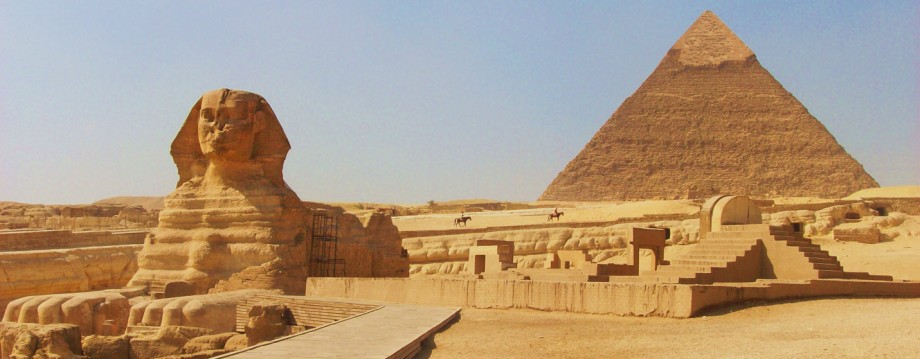
In the previous publication «Geodesy of meridians» the regularities found in an arrangement of meridians of known historical objects were described. It became clear that meridians of such constructions, as the Great pyramid, Tiwanaku, Theotiuacan, monuments of Easter Island and Vera Island, and sacred rock Uluru in Australia are located relatively each other with a step to multiple 10 degrees. Meridians of these objects form system, in which longitudes of separate objects are a symmetry axis for other meridians.

As it is known all meridians, unlike latitudes, have identical length and pass through planet poles. All meridians are Big circles or the ortodromias connecting on the shortest distance Northern and Southern poles.In this article it will be a question of interaction of latitudes of the same historical objects in which arrangement even more interesting regularities allowing with full confidence to speak about existence of system in an arrangement of the most considerable and monumental constructions of an antiquity were found. Read More…

Categories: Uncategorized | Leave a comment

SYSTEM OF ANCIENT MONUMENTAL STRUCTURES. GEODESY OF MERIDIANS.

In previous publications «ORIENTATION OF TEMPLES IN THEBES AND VALLEY OF KINGS» and «SYSTEM OF ANCIENT MONUMENTAL STRUCTURES» some words were told that meridians and latitudes of some known ancient constructions have curious regularities in the arrangement relatively each other. So, the meridian of Great Pyramid (GP) is a symmetry axis perpendicular to the meridians of Tiwanaku and Uluru, and the meridian of Easter Islandis an axis of symmetry of the meridians of Teotihuacan and Vera Island, and practically with identical values close to 10 degrees.

Upon further study of the characteristics of the location of the meridians most significant and monumental buildings of antiquity revealed that most of them are directly related and are a system similar to the modern geodetic system.

If the equator – a natural baseline Latitude, it is equally obvious equivalent to the reference longitude missing. In the II century AD. e. Ptolemy oriented own meridian with the blessing of the islands (then called the Canary Islands), which, in his view, is the westernmost point of the world’s population. In the Age of Discovery, followed the discovery by Columbus in the New World in 1492, almost every state to use its own meridian.

That fact is little-known that when in 1884 at the International meridian conference in Washington the point through which will pass prime meridian along with Grinvich was defined, for this right applied Paris and … A Great Pyramid in Giza. If then a zero meridian carried out through GP, everything would rise on the places. More…

Categories: Uncategorized | Leave a comment

SYSTEM OF ANCIENT MONUMENTAL STRUCTURES

SYSTEM OF ANCIENT MONUMENTAL STRUCTURES


For the first time the hypothesis that the ancient megalithic structures may be located on our planet on a particular system, launched in 70 years, Russian scientists N.F.Goncharov, V.A. Makarov and V.S.Morozov. According to their theory , the kernel of the Earth is a growing crystal of iron, which brings in all the shells of the planet right symmetry of the two Platonic polyhedra – the icosahedron and dodecahedron, and the hierarchy of subsystems, the main division. On the tops of the crystal, just as the majority of seats and is situated the ancient civilizations, pyramids and other famous buildings. Although in this symmetric system really is coincidence with the location of historical sites, all of them is quite approximate.

Then a famous Bashkir physician and researcher of ancient civilizations Ernst Muldashev offered his system of pyramids, in which he linked the location of Giza, Easter Island, Mount Kailash and a few other famous places. Unfortunately, the system was crude and could not stand the geographical test. But the great merit of Ernst Rifgatovich in another. Through his books not new, but rather fantastic idea, the presence of the location of ancient monuments, became very popular. Hundreds of researchers have begun their own investigations in this direction, and I must say have made ​​very significant progress. The most interesting articles on this topic are available on our website under “Historical Geodesy” .

Thus, in the article ” Jim Allison’s Lines” have been described Great Circles joining some famous historical sites. One of them, the line of the Great Pyramid (GP) – Easter Island is a well-known figures in the desert of Nazca and many other sacred places. Moreover, the Nazca lies in the golden section of the line between the GP and its antipode. In addition, this line, which can be safely regarded as one of the principal, has a number of remarkable properties and laws, which will be discussed a little bit lower.

If to research more in this direction, and connect the most significant buildings of antiquity to each other by lines, as well as to their latitude and meridians, you will get a global network of lines covering the entire planet. In the process, the network revealed distinct patterns for the first time allow us to say that there are certain system in the arrangement of the pyramids, temples and other megalithic structures.

As reference points for the lines on the principle of monumentality, was chosen the most famous and important historical sites: Great Pyramid (GP), Stonehenge, Theotiuacan, Tiwanaku, Easter Island, Nan Madol, Baalbek, Angkor, Lalibela, religion centers – Jerusalem (Temple of Solomon), Mecca, Vatican, Great Zimbabwe in Africa, saint rock Uluru in Australia, Por Bajyn и Vera Island Megaliths in Russia.


ситема древних монументов


In this publication, dedicated to the great circles shown some regularities in the distribution of historical objects, which is actually much more. Their careful study, organize, and search for principles of the system – the near future. But so far, the theory of paleocontacts and existence in the ancient planetary advanced civilization first real evidence to get the most incredible part.

It seems that the famous pre-historic buildings are part of the ancient geodetic or navigation system, in which the pyramids and temples, along with other functions, serve as landmarks and reference points clearly visible even from space.

On the interactive map at the end of the article can be seen most of these laws. The most correct map is displayed in the browser Mazila Firefox. To view an interactive map, you must install the Google Earth plugin.

Read more

Categories: Uncategorized | Leave a comment

ORIENTATION OF TEMPLES IN THEBES AND VALLEY OF KINGS

ORIENTATION OF TEMPLES IN THEBES AND VALLEY OF KINGS

In recent years there is growing evidence that well-known historic objects are located on our planet not chaotically, but with a definite system. Researchers again and again discover the different laws connected with location and orientation of ancient structures. Read more…

Categories: Uncategorized | Tags: | Leave a comment

Files for Google Earth

Now in the "FILES" you can view and download files with the extension (. Kmz) for the Google Earth. The files contain many interesting and useful information about the pyramids, megaliths, ancient cities and many other historical objects. Now you can travel to the ancient world, learning about it many new and unusual. You can choose to explore the the laws in the arrangement of ancient sites and try to unravel the mystery of Nazca. Best of luck.  

Examples:

HISTORICAL OBJECTS;    VIEW   DOWNLOAD
This file contains the locations of historic sites and structures on the Earth, as well as information about them.

NAZCA AND PALPA GEOGLYPHS;   VIEW    DOWNLOAD
The file shows the location of most of the geoglyphs in the central Nazca. Wait for the file (1.2 Mb). 

CHINESE PYRAMIDS;    VIEW   DOWNLOAD
The file shows the location of the pyramids in China.

Categories: Uncategorized | Leave a comment

Mayan Secrets to Be Revealed by Mexican Government in ‘2012’ Doc

The Mexican government is releasing state-held secrets about the end of the Mayan calendar to the makers of a documentary, “Revelations of the Mayans 2012 and Beyond,” TheWrap has learned.
The information — protected for 80 years — is expected to reveal Mayan beliefs in future catastrophes and wisdom characterized as “shocking,” producer Raul Julia-Levy, son of actor Raul Julia, told TheWrap.
The end of the Mayan calendar in December 2012 has long given rise to theories and speculation about the end of the world.
The agreement will allow Julia-Levy to film in never-before-seen locations. READ MORE

Categories: Uncategorized | Leave a comment

Create a website or blog at WordPress.com